

Learning and collaboration at 12,000 feet: AGCI leads soil moisture research campaign on Colorado’s Independence Pass
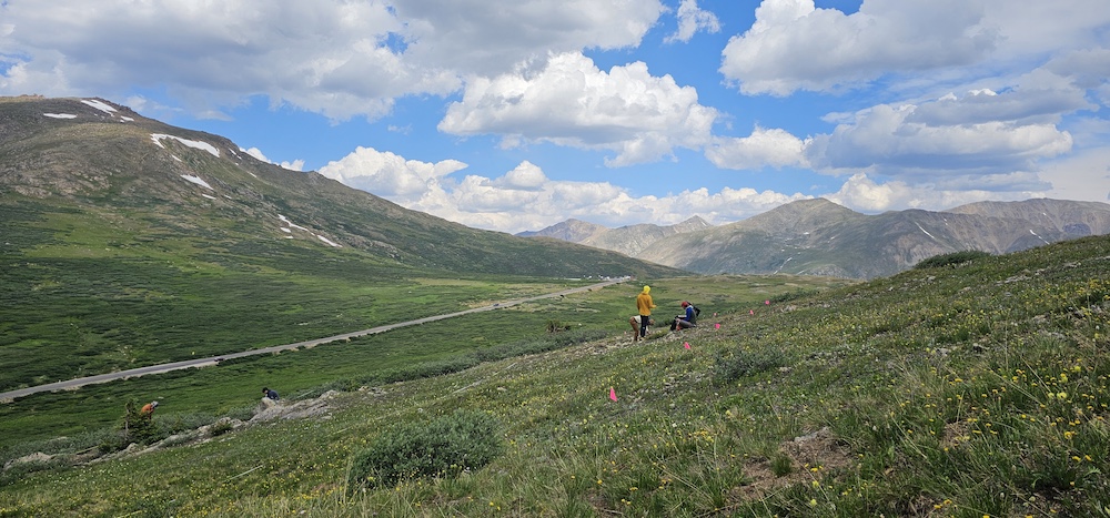
In the mountain watersheds of the West, the soil beneath our feet quietly determines how long snowmelt lingers, how plants survive through summer, and how streams are fed. To monitor these dynamics, AGCI’s Roaring Fork Observation Network (also known as iRON) operates ten monitoring stations throughout the Roaring Fork watershed, each collecting near real-time soil moisture data. But how well does soil moisture data from a single station represent the complex alpine landscape around it?
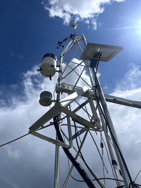
This past summer, AGCI set out to answer that question through one of our largest soil moisture field research campaigns to date. From July 14–17, 15 researchers converged around the Independence Pass station at 12,200 feet to better understand soil moisture data coming from that station. Participants included AGCI research staff, graduate students from the University of Colorado Boulder’s Masters of the Environment program, and summer interns, as well as local partners like Sally Cariveau, Yampa Valley Sustainability Council Resilient Water Program Manager; Nathan Stewart, Colorado Mountain College Ecosystem Science & Stewardship professor; Glenn Patterson, retired USGS researcher; and Elise Osenga, Program Coordinator for the National Coordinated Soil Moisture Monitoring Program (and former AGCI Community Science Manager).
Testing assumptions on the ground
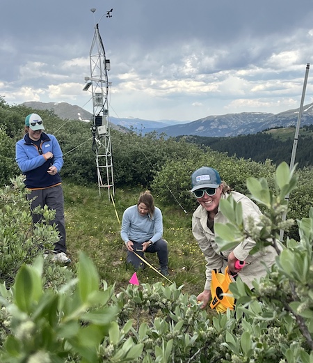
“When we first built these stations, we tried our best to place them in areas we felt would be representative of different parts of the Roaring Fork watershed and provide a good picture of different vegetation ecozones and elevations,” said AGCI Research Technician Asa DeHaan. “But this week was a chance to test those assumptions by gathering lots of hard data.” Working in teams, the researchers staked an approximate 100 x 100 meter grid centered around the station, then took soil moisture readings every five meters using handheld sensors. On the first day of data collection alone, the teams collected 800 data points. By week’s end, the group had logged far more data over a much larger area than had been collected on previous efforts.
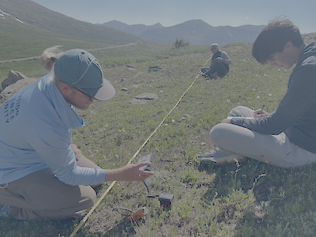
Fieldwork rarely goes as planned, and quick pivots are often required. The team expected to use four soil sensors—one for each grid quadrant—but arrived to find only two were usable. Rather than halt the project, they adapted by consolidating into two larger groups. They also needed to adapt how they set up the testing grid and how they digitized the data from handwritten field sheets onto computers. But, overall, they encountered no major problems.
Learning and collaboration in the field
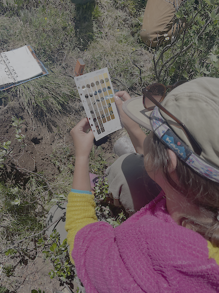
The alpine setting was both spectacular and demanding. Participants worked long days under strong sun and shifting clouds, often racing afternoon monsoon storms that forced them to retreat back to camp. Evenings were spent at Twin Lakes’ Lakeview Campground—sharing meals, comparing notes, and planning the next transects. The field week provided ample opportunities for mentorship and learning. Asa recalled working with University of Washington graduate student Rachel Buchler, who helped characterize soil samples by texture and color across the study area. “I loved learning from her,” he said. “She was wonderful at describing everything she was doing, and it helped to demystify soil science at this level for me.”
For Oliver Smock, a Colorado State University undergraduate intern cohosted by AGCI and the University of California’s San Diego’s Center for Western Weather and Water Extremes (CW3E), the week was a first immersion in alpine field science. Now back at campus, he’s cleaning and analyzing the dataset as part of his summer project. “I get to take what we collected on the Pass and turn it into maps and patterns,” Oliver shared. “It’s exciting to see the story emerging from the data.”
The joint field week was also an opportunity for local partners to come together and deepen a burgeoning collaborative effort focused on soil moisture in the Colorado River Headwaters. “This collaboration shows how valuable it is to bring community groups, students, and scientists together in the same place,” said Sally Cariveau of the Yampa Valley Sustainability Council. “We all left with a deeper sense of how interconnected soil, water, and people really are. We’re already looking forward to next summer!”
Early observations
It’s too early for conclusions, but a picture is emerging of the spatial variability and relative representativeness of the station to the field around it. “The next question we need to tackle is better understanding the patterns in the data,” says AGCI Environmental Science Researcher Tanya Petach. “How much can the variability in soil moisture that we’re seeing be tied to differences in vegetation, elevation, soil type, or other measurable variables?” These metrics will help in understanding how to take point-based soil moisture data and integrate them across an entire watershed to estimate watershed-scale soil moisture.
Looking ahead
The Independence Pass campaign marked a turning point for AGCI’s long-term soil moisture research. It demonstrated the power of scaling up data collection and confirmed the value of testing long-held assumptions. The results will feed into future watershed studies and help refine how single-point data is interpreted across landscapes.
Learn more about AGCI’s Roaring Fork Observation Network and how this work is shaping understanding of water resilience in the U.S. West.